The Ditch That Became a Jurisdiction: Rebuilding Site Plans After Wetland Rules Shift
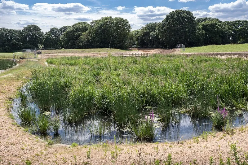
Photo: Christine Matthews , CC BY-SA 2.0, via Wikimedia Commons
When the Ground Rules Change Mid-Project
For most of the last decade, the question of which waters fall under federal jurisdiction has been answered, overturned, and answered again. The Supreme Court's 2023 decision in Sackett v. EPA narrowed the reach of the Clean Water Act, and federal agencies have since revised the definition of 'waters of the United States' — even as litigation and state-level rulemaking continue to redraw the map. The practical consequence for anyone holding an approved site plan is uncomfortable: a wetland delineation that satisfied regulators eighteen months ago may no longer reflect the jurisdictional reality on the ground today.
The exposure is not theoretical. A drainage swale, an agricultural ditch, or a seasonally ponding low area that was excluded from your jurisdictional determination can be reclassified by a revised rule, a new agency guidance memo, or a state program that steps in where federal oversight recedes. When that happens, grading plans, stormwater designs, and construction sequencing can become non-compliant overnight — often after earthwork has already begun.
The Re-Verification Audit: Six Steps
Facility managers and developers with sites near streams, ponds, drainage corridors, or low-lying acreage should treat wetland status as a living condition, not a closed file. A disciplined re-verification protocol includes:
- Pull the original jurisdictional determination. Confirm whether it was an approved JD, a preliminary JD, or an informal delineation, and note its date. Preliminary determinations carry no legal insulation and deserve the closest scrutiny.
- Check the current rule and pending litigation in your circuit. Jurisdiction can differ by federal district, and state definitions may be broader than the federal floor. In states like California, New Jersey, and Washington, isolated wetlands remain fully regulated at the state level regardless of federal posture.
- Commission a fresh delineation if more than two to three years have passed. Hydrology, vegetation, and soils shift — and so does agency interpretation of the same field data.
- Re-examine 'non-jurisdictional' features specifically. Ditches, ephemeral channels, and wetlands without surface connections were the features most affected by the Sackett standard; they are also the features most likely to be revisited.
- Map the buffer against your current footprint. A delineation line that once cleared your building pad by a comfortable margin may now clip a detention basin or parking expansion.
- Document everything. A dated, professional delineation report is your best evidence of good faith if the agency's position changes later.
Permit Triggers You May Have Missed
A reclassification typically activates a cascade of obligations. Section 404 permits from the U.S. Army Corps of Engineers, Section 401 water quality certifications delegated to the state, state-isolated wetland permits, and local stormwater approvals can all be implicated. Each carries its own timeline — and a 404 individual permit can take many months, longer if compensatory mitigation is required.
The compounding risk is sequencing. Under the Clean Water Act, permits must generally be in hand before discharge occurs. A contractor who pushes dirt through a now-jurisdictional channel before the paperwork catches up has created an unauthorized fill event, which carries its own enforcement path and restoration orders.
Building Flexibility Into the Plan
Rigid site plans are fragile site plans. The resilient designs we see succeed share common traits:
- Setbacks sized for uncertainty. Treat jurisdictional boundaries as ranges, not lines. A 25- to 50-foot contingency buffer around flagged features absorbs most re-delineations without a redesign.
- Phased civil packages. Separating grading, utilities, and vertical construction into independent permit packages lets you adjust the wetland-dependent phases without stalling the entire schedule.
- Alternative stormwater routing. Designing outfalls and conveyance with at least one alignment that avoids flagged features preserves options if a channel is reclassified.
- Mitigation banking credits secured early. Credits from an approved bank can be purchased in advance and held, converting a potential permit bottleneck into a solved line item.
- Contractor clauses tied to jurisdictional status. Make clear in construction documents that work near flagged features pauses upon any agency notice, protecting both parties.
The Cost of Waiting
Remediation of an unauthorized wetland fill routinely exceeds the cost of avoidance by an order of magnitude, before fines and legal fees. Compare that to a delineation update and a setback adjustment on paper — the economics are not close.
For properties near water features or drainage corridors, the sound assumption is that the regulatory ground will move again. The organizations that weather these shifts best are the ones that audit jurisdictional status annually, design with buffers instead of boundaries, and keep environmental counsel and a qualified delineation consultant on call before the letter arrives — not after.
If your approved plan predates the current federal definition, or your site borders a channel whose status was ever in question, a targeted compliance review is the least expensive insurance available in environmental permitting today.